 Movilytics
Public transport data, ready to use.
A platform where you can explore, download, and process mobility data at city scale. Visualize patterns, evaluate performance, and build indicators.
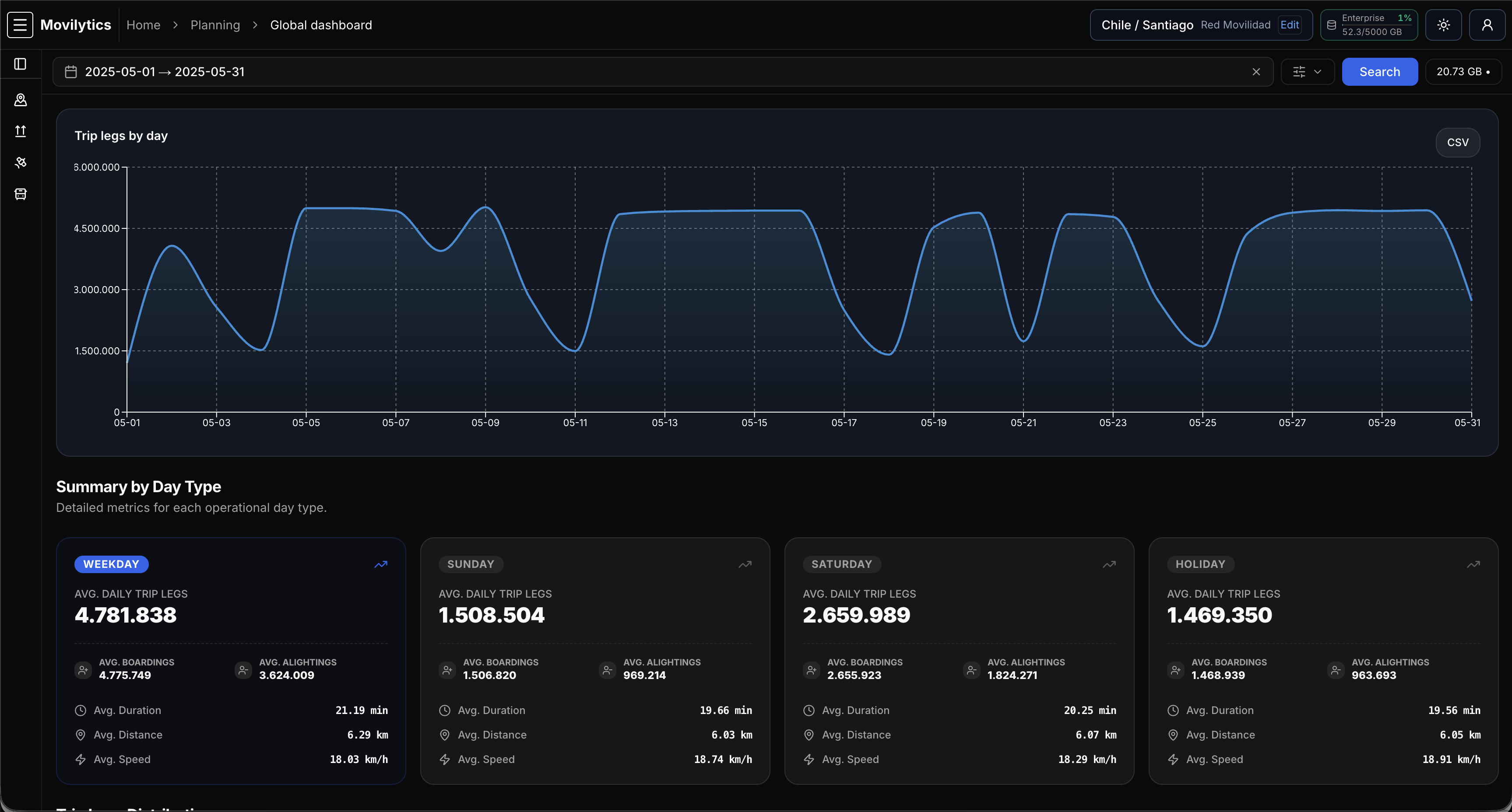
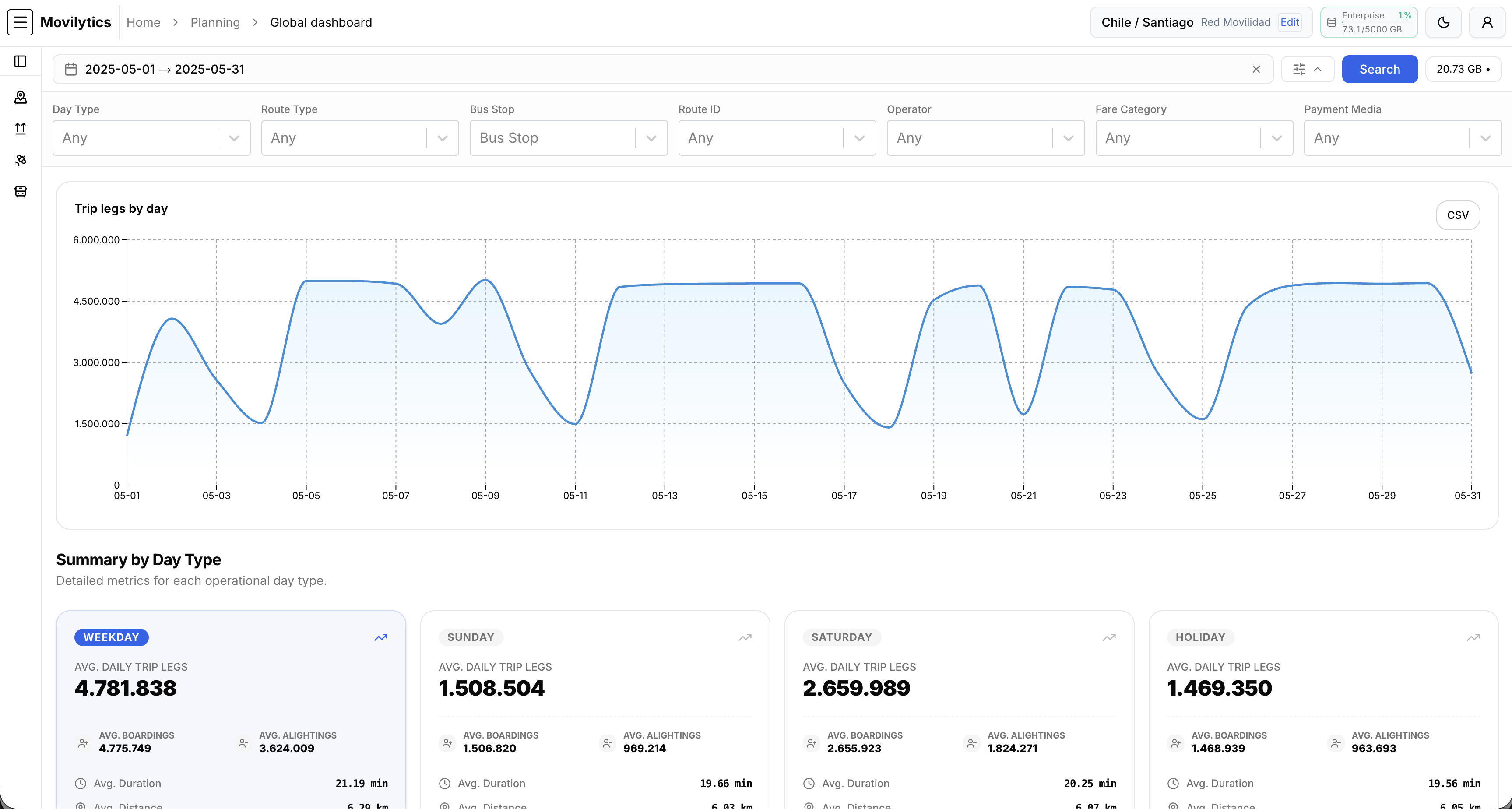
Platform at a glance
System overview
AvailableGeneral overview of all analytics-ready planning datasets.
Countries
1
Cities
23
Records
2,871,367,422
Storage
986,58 GB
Data Range
2024-2026
Built for city data ecosystems and regulated public-transport systems
Core services
Everything you need to work with transit data
Choose modules based on your needs: from raw data to standardized datasets, APIs, and processing workflows.
Clean, standardized datasets
Direct access to processed mobility data (GPS, GTFS/GTFS-RT, transactions, speeds) with consistent schemas and clear metadata.
Geo + time visual analytics
Interactive maps, heatmaps, and time series to explore patterns by area, corridor, route, or time window.
Operational indicators
Reliability, punctuality, occupancy, commercial speeds, waiting times, and compliance indicators — ready to use.
Unified catalog
Centralized access to cities, networks and periods; input versioning and full processing traceability.
Downloads & APIs
Bulk delivery (CSV/Parquet) and authenticated query APIs with filters by date, route and territory.
Why Movilytics
Practical value, from day one
Movilytics removes the heavy lifting so you can focus on research, planning, oversight and operations.
Save time with clean, structured data
Skip complex ETL and manual cleaning. Use standardized datasets ready for analysis.
No infrastructure headaches
Storage and compute at city scale are hard to handle on a personal computer. We take care of it.
Access anytime, at any scale
Explore years of historical data and large volumes whenever you need.
Query smart, not raw
Use curated views to get digested results quickly, even across multiple years.
Multi-city + real-time oversight
Monitor speed, demand, punctuality and compliance across integrated city datasets.
Examples of what you can do
- Query years of data in seconds
- Download curated extracts (CSV/Parquet)
- Monitor operational indicators over time
Illustrative preview — tailored per city and data availability.
For your team
Advantages by customer type
A single platform adapted to oversight, research, and operational performance.
Governments
Supervise and analyze public transport operations by city/zone — in real time and historically. Support oversight with reproducible indicators and evidence.
Universities & Research Centers
Get historical datasets for papers and theses, and validate models with real-time feeds. Work faster with standardized, city-scale data.
Bus Operators
Save time using standardized operational data to improve performance, detect issues, and support planning and operations.
Pricing
Simple, transparent pricing
Start for free. Standard, Premium and Enterprise are available by contacting us.
Free
$0
- Browse all available dashboards and views
- Access and download all public datasets
- Data usage limit: 20 GB / month
- Best for exploratory analysis
Standard
$50/month
- Browse all available dashboards and views
- Access and download all public datasets
- Data usage limit: 100 GB / month
- Best for teams and ongoing analysis
Premium
$250/month
- Browse all available dashboards and views
- Access and download all public datasets
- Data usage limit: 1 TB / month
- Access to your private datasets
- SLA and audit options
- Best for continuous and real-time analytics
Enterprise
$500/month
- Browse all available dashboards and views
- Access and download all public datasets
- Data usage limit: 2.5 TB / month
- Access to your private datasets
- Custom integrations
- API access
- SLA and audit options
- Email support
- Best for continuous and real-time analytics
Ready?
Explore your city's transit data today.
Start for free, no credit card required. Upgrade when you need more.
FAQ
Got questions?
Contact
Let's talk
Tell us your city, available data sources, and goals. We'll propose a concrete scope within days.
- Access for your team and stakeholders
- Secure ingestion from your sources
- Priority Value and dashboards
Interested in Premium or Enterprise? Use this form and we'll get back to you.